Category Archives: Bleaklow

Video #100 – YouTube Trailer

This is my 100th YouTube Video, It will also double up as my Channel Trailer. It is a collection of footage from the last few years which hold some great memories for me. there is snippets from walks in the Peak District, adventures in the Lake District, The West Highland Way in Scotland and also a few from local walks or rides. I had so many memories and footage to choose from I had to be pretty strict.

I knew I had to attempt to pull something out of the bag for this one so I have also layered it all over a Drum & Bass Remix I made especially for the video. I use a sample from the Gladiator Soundtrack from the track “The Wheat”, you may also notice I have included a quick remake of that scene towards the start of this movie. I hope you enjoy it 🙂

The Pennines Way – 7 Days from Edale to Thwaite

This is an HD video of my Pennine Way adventure in April 2013, we walked for 7 Days from Edale to Thwaite and it was a thoroughly enjoyable experience. I uploaded a lot of this footage in daily updates but this is the full HD version. Thank you to everyone who followed at the time and I hope to venture back again soon to tick of the northern half of this great trail. In the next few weeks I will be updating the existing Pennine Way posts with images from my DSLR. I will also be doing a summary video blog to share my thoughts about the journey and what lessons I have learned 🙂

20130512-151043.jpg

The Pennine Way – April 2013

A few weeks ago I mentioned that my friend Chris (@PilgrimChris) and I would be walking the Cape Wrath Trail in Scotland. It is a stunning route starting in Fort William which weaves its way up to the most north western tip of Scotland at the Cape itself. As things often do in life, plans change, new ideas form and opportunities present themselves. So I’m writing this post to say that this coming April, Chris and I will be tackling the Pennine Way. Many reasons have promoted us to decide to postpone the CWT adventure and hopefully I’ll be able to share more very soon.

20130315-134235.jpg

The Pennine Way is a route that I always knew that I would like to do, I’ve walked sections of it in the past and thought that it would be great to tackle it in its entirety. The route meanders 268 miles from Edale in the Peak District, via the Yorkshire Dales, Hadrian’s Wall, Northumberland and then finishes at Kirk Yetholm in the Scottish Borders. Obviously I’m a sucker for the Peak District, the Dark Peak has become a firm favourite for my walks and it will be great to set off from a familiar place. Another one of the reasons why I thought I’d love to do the PW is due to my recent holiday in Edinburgh, we drove up past Hadrian’s Wall and through Northumberland. It looks like a stunning area I can’t wait to walk there and to learn more along the way.

20130315-134553.jpg

Chris and I are keen advocates of ShareYourAdventure.com and the journey along the Pennine Way will be a very social event. It would be great if people would like to meet up along the way to walk with us, you could even join us for a wild camp if you so wish. If you can’t spare the time or don’t fancy a walk then why not just meet us to say hello.

We will be Sharing Our Adventure in many ways, via this Blog, on ShareYourAdventure.com, twitter, Google+, AudioBoo and YouTube. We hope to make this journey as media rich as possible and look forward to taking you along with us in spirit or even in person. More info will be coming very soon about where we will be at particular times, so if you fancy meeting up for a walk, a chat or a drink then give us a shout 🙂

20130315-134122.jpg

Peak District – Bleaklow in the Snow

It always seems that when my friend Andy and I go walking we always get rain. We don’t mind though as we will walk no matter what the weather, today however the roll of bad luck had finally ended. We got the most beautiful wintery conditions with perfect blue skies, snow, ice and the hills to ourselves. We sett off from Birchin Clough at around 09:45, headed down in the Lady Clough and then up the path through the Pine Forest. We crossed over to Doctors Gate, walked along the Roman Road and then swung northward along Devil’s Dike. We had a great walk up to the summit of Bleaklow, swung eastwards to Bleaklow Stones and then headed back down via Grains in the Water. We climbed over the moors once again and then made our way back to Lady Clough via Upper North Grain. It was a lovely winter wander that I will write more about very soon… For now why not have a look at the images, the Social Hiking map and have a listen to the 3 AudioBoos from today.

Lady Clough Forest

Lady Clough Forest

Lady Clough Forest

Lady Clough Forest

Lady Clough Forest

Lady Clough Forest

(function() { var po = document.createElement(“script”); po.type = “text/javascript”; po.async = true; po.src = “http://d15mj6e6qmt1na.cloudfront.net/assets/embed.js”; var s = document.getElementsByTagName(“script”)[0]; s.parentNode.insertBefore(po, s); })();

Lady Clough Forest

Lady Clough Forest

Doctor's Gate

Doctor’s Gate

Pennine Way looking towards Kinder Scout

Pennine Way looking towards Kinder Scout

(function() { var po = document.createElement(“script”); po.type = “text/javascript”; po.async = true; po.src = “http://d15mj6e6qmt1na.cloudfront.net/assets/embed.js”; var s = document.getElementsByTagName(“script”)[0]; s.parentNode.insertBefore(po, s); })();

Devil's Dike

Devil’s Dike

Bleaklow

Bleaklow

Bleaklow Peat Groughs

Bleaklow Peat Groughs

Bleaklow - Mountain Hare Tracks

Bleaklow – Mountain Hare Tracks

A Snowy Bleaklow

A Snowy Bleaklow

Bleaklow Stones

Bleaklow Stones

Bleaklow Stones - iPhone Panorama

Bleaklow Stones – iPhone Panorama

Alport Dale from Grains in the Water

Alport Dale from Grains in the Water

Alport Moor - Kinder Scout

Alport Moor – Kinder Scout

Upper North Grain Hut

Upper North Grain Hut

Upper North Grain Hut

Upper North Grain Hut

Upper North Grain

Upper North Grain

Upper North Grain

Upper North Grain

(function() { var po = document.createElement(“script”); po.type = “text/javascript”; po.async = true; po.src = “http://d15mj6e6qmt1na.cloudfront.net/assets/embed.js”; var s = document.getElementsByTagName(“script”)[0]; s.parentNode.insertBefore(po, s); })();

Nether North Grain

Nether North Grain

Lady Clough Forest

Lady Clough Forest

Lady Clough Forest

Lady Clough Forest

Lady Clough Forest Logging

Lady Clough Forest Logging

Lady Clough Forest

Lady Clough Forest

Peak Routes Podcast – Episode 1 – Bleaklow

The very first episode of the Peak Routes Podcast is now live and available for your listening pleasure. This is my first attempt at podcasting so please ignore the occasional wind noise and the breaks in concentration 🙂

This episode documents the route I did on the 29th of February 2012 which can be found at Peak District – Bleaklow. The route starts at Birchin Clough, goes via Lady Clough, Doctor’s Gate, The old Roman Road, The Pennine Way, through Devil’s Dike up to Bleaklow. I then turn eastward and head across the peat bog to Bleaklow Stones. After a short break I then descend to Alport and then climb steeply up to the top of Nether Reddale Clough. I then admire the via down into Alport Dale before heading over the top of Alport Moor to the head of Birchin Clough. A short while later I arrive back down at the car park at the Snake Road.

This episode is no longer available from iTunes, If you would like to download this episode or any from the archive then visit the dedicated Podcast page of the site.

Peak District – Bleaklow

Another week and another brand new route. I decided once again to head for the Birchin Clough car park on the Snake Road, this place has fast become a firm favourite for me. The area is just simply stunning. The beautiful pine forests with Kinder Scout lurking to the south makes for great viewing. Today however, the aim wasn’t Kinder, it was another peat covered favourite by the name of Bleaklow.

I set off from the Birchin Clough car park at around 10am and headed over the road down into the forest. I headed north following the river that winds under pines up Lady Clough. Today was to be the day that I would make the very first PeakRoutes.com podcast. I begun recording an introduction as I meandered alongside the tranquil flowing river. It had been an idea spawned by my frequent AudioBoo entries with which I had been summarising my walks in audio form. I decided it would be a great addition to my websites to have a larger audio accompaniment, even if no one was to listen it would be a great historical record to have an audible account as well as images.

The going was good today and I made swift progress through the forest as the track climbed up and away from the river. It rose towards the edge of the road and then dropped back down again as I prepared to leave the edge of the forest. Lady Clough opened out in front of me and I could then see the cloud hugging the surrounding hills. After crossing a stream that flows into Lady Clough river I climbed upwards to walk along side the Snake Road.

I crossed over the road at OS Grid Reference SK 0962 9287 and headed for Doctor’s Gate. I recorded another part for the podcast and then joined the Roman Road that rises to meet the Pennine Way. By this point I was rising into the cloud base and the mist was surrounding me. I proceeded upwards along the ancient route and listened to the sound of the grouse as I let my mind wander. It was at this point as I marched on through the mist along the cobbled path that I wondered what if must have been like here in Roman times. I could picture in my imagination the sight of a group armoured Roman soldier marching out of the mist towards me. How fantastic would it be to be able to wind back the clock to witness such a sight.

Anyway… Back to the work. I met the Pennine Way at SK 0900 9332 and turned north towards Bleaklow. The mist was thick and visibility was down to around 20 metres maximum at this point. I proceeded along Devil’s Dike which rises gently, the path then winds through Groughs and around Cloughs as it makes its way up to Bleaklow Head.

In no time at all I was standing at the very top of Bleaklow. I had not seen another soul or soul less person all morning 🙂 the place felt very bleak indeed as the cloud silently brushed across the top of this vast expanse of peat. I recorded another section of audio and then found the path over towards Bleaklow Stones.. I say the word “path” very loosely as there isn’t really a path of sorts. There Is a faint track that weaves across while you follow the Stake marked grass covered Groughs.

The route can become rather confusing at this point if you don’t keep your wits and your compass about you. I have learned from previous experiences that the thing to do is walk on a bearing and ignore what is happening under foot. The paths that do appear along this stretch are rather misleading. You begin to follow what looks like a path for it to fizzle out to nothing or spin around in totally the wrong direction. As I just said, the key to success in cloudy condition along this section is to walk on a bearing.

20120301-015526.jpg

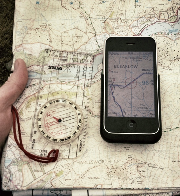
After an exhilarating 30 minutes of navigational skill refreshing I arrived at Bleaklow Stones, I was very surprised to have 3G signal so I placed my backpack down and begun broadcasting some live video to Bambuser. Not that you could see a great deal but you do get a good idea of what it was like for me up there today.

(function() { var po = document.createElement(“script”); po.type = “text/javascript”; po.async = true; po.src = “http://d15mj6e6qmt1na.cloudfront.net/assets/embed.js”; var s = document.getElementsByTagName(“script”)[0]; s.parentNode.insertBefore(po, s); })();

After a short break and an AudioBoo submission I decided to keep moving. Last time I was here I walked up from Howden Reservoir and the weather was stunning, I sat and admired the view for what must have been half an hour. The low cloud today however meant that the view was rather less spectacular. Not to worry, I soon began dropping down towards “The Ridge” and I was amazed to see a handful of mountain hares out in front of me. They looked spectacular with their brilliant white coats against the dark greens and browns of Alport Moor.

I decided to have a slight change of route at this point. I had originally planned to head across the top of Alport towards Alport Castles, drop down to the mouth of the valley and then pick up the roman road back to the car park. I have done this sections before in the past so I decided to go a little off piste and explore some areas where I have never set foot before. I chose to head down into Alport Dale from SK 1148 9461, I headed down towards the river and followed its course for a few minutes. I decided to head back up out the other side of the valley and climb up to the top near SK 1154 9353. The view from here was magnificent.. If the climb alone wasn’t enough to take my breath away then the view certainly was. The view down Alport from this angle is stunning.

I carried on along the moor and crossed the top of Nether Reddale Clough, there are no paths here but I was below the cloud base so made a beeline for the head of Birchin Clough. I was once again met by another glorious view. An angle over towards Kinder that I had never witnessed before. The northern edge of Kinder was framed perfectly by the falling hillsides at Birchin Clough and the spruce lined banks of Lady Clough. I was glad that I had diverted from my original plan as I saw a new side to Alport Moor.

In no time at all I had begun the steep decent down the path from SK 1095 9163 to the car park. I had managed to record a good half an hours worth of audio for the podcast, I’m sure I’ll probably thin this down to around 20 minutes during the editing process though. Another great new route, some old favourites revisited and some new places discovered.

Keep an eye or ear out for the forthcoming podcast. I’m a newcomer to podcasting so will have a look into the logistics and get a link posted here for you to be able to grab it from iTunes. Thanks for reading and your continued support. Join me again next week when I will hopefully be heading further north towards Black Hill. Images, words, video and audio will follow swiftly afterwards.

Peak District – Howden, Bleaklow & Alport – Video

Here is a video I recorded while on my walk today in the Peak District. It is just a quick sequence of shots I did using my old Canon A640, so it’s not HD but you can get a feel of what it was like up there today on a cold wintery day. I set off from Howden Reservoir, Followed the River Derwent to its source, Headed up and over the moors to Bleaklow Stones, Down to Alport Castles and then back across Birchinlee Pasture to Howden.

I hope you enjoy it and the wind noise isn’t too annoying 🙂

The blog post for this walk which contains numerous images, a Social Hiking map and an AudioBoo can be found here…. Peak District – Howden, Bleaklow & Alport

Peak District – Howden, Bleaklow & Alport

After my windy walk with Andy last week (“Peak District – Ladybower & Alport Dale”) I decided it was high time for another Peak District outing. There has been rather a drought when it comes to walking of late, what with one thing and another I just haven’t had the time to head out. I feel as though I have made up for it today though with a good route and some fantastic views thrown in, so without further ado here is my summary of where I headed and what I got up to.

Looking westward towards Barrow Stones
Read more of this post