Having looked at my Dark Peak Combi Map on http://www.shareyouradventure.com I decided I needed to fill in the last remaining space on Kinder Scout, it was the final piece in the jigsaw to make that area of the Peak District look explored. I have walked this way a handful of times in the past but it has been over a year. The last time I walked to this point was when I camped on the eastern edge of Kinder, so I thought it was high time I returned.

We set off at 10am from the Birchin Clough car park on the snake road and headed over to Lady Clough Forest. Lady Clough forest is quickly becoming a new favourite area in the Peak District for both myself and my friend Andy who was with me today. We followed the river down stream to the point where it joins Ashop River and then walked eastward. We followed the rough path along the banks of the river down towards the bridge at OSGB Grid reference SK 1142 9015.
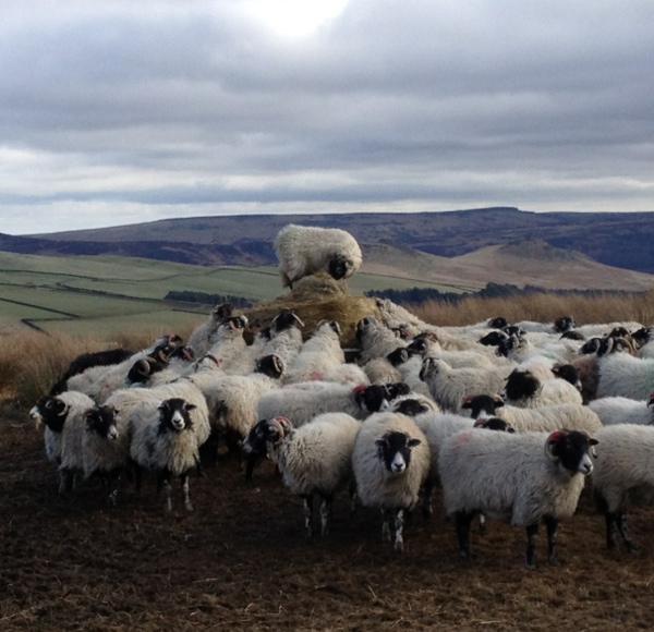
After crossing the bridge over the river Ashop we then had to cross Fairbrook to enable us to pick up the path that rises to Seal Stones. We walked through the sheep pens and then began the rather steep and unrelenting climb of approximately 300metres of accent up to Seal Stones at SK 1137 8886. It’s rather a slog and it get pretty steep towards the end. Not a problem really as Andy and I chatted the whole way up so it was over in a short space of time.
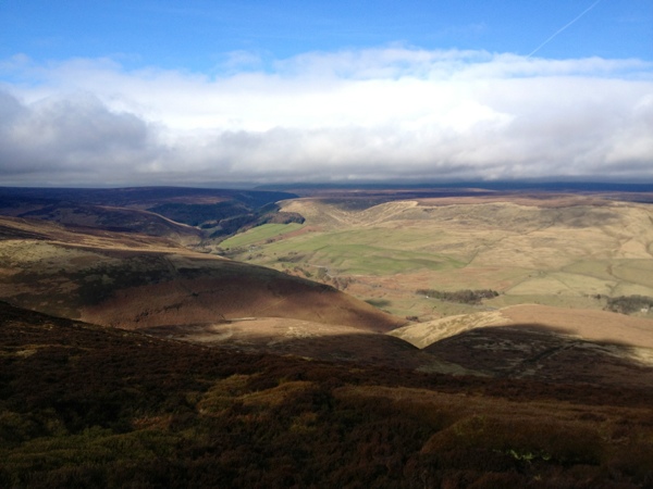
When we arrived at Seal Stones we were at the base of the clouds, We picked our way eastward along the edge of the plateau around to the top of Blackden Brook. The cloud had begun to break at this point and the sun was shinning down on the hills across the Ashop valley and beyond.
The going was good today along Blackden Edge and after negotiating a few boggy patches we arrived at a rock formation near madwoman’s Stone at grid reference SK 1390 8807. We decided it would be a great place to stop for lunch and admire the views while sheltering from the wind. I begun to survey the surrounding area towards the east and it suddenly dawned on me…
In the last 8 months I had climbed to the top of every Hill, walked along every edge and meandered through every valley that I could see. Towards the north I had walked on Bleaklow, then looking clockwise I had stood atop Margery Hill and walked the entire length of the Derwent Edge. I had walked along Stanage and Bamford Edges. I remembered the day I walked the Edale Skyline route and finished upon Win Hill after starting at Lose Hill. I had left no feature unchecked from my list of Peak District achievements. It was at that moment that moment the idea of http://www.PeakRoutes.com took shape. I knew it was high time that I set up a website where I could share all my Peak District routes and experiences… Yes… I already do that on http://www.DeanRead.net but I wanted to create a site that was 100% dedicated to my love of the Peak, it would be my launch pad to promote the joys I have had from walking here. Peak Routes was born 🙂
After our short break for lunch we left the Kinder Plateau and headed down towards Hope Cross, we joined the old Roman Road and headed north west down into the valley. We crossed the ford at SK 1407 8944 and just about managed to keep our feet dry. I’m sure there must have been a bridge over the water here at some point but sadly there isn’t anymore, after periods of heavy rain you would struggle to find a way across the river at this point.
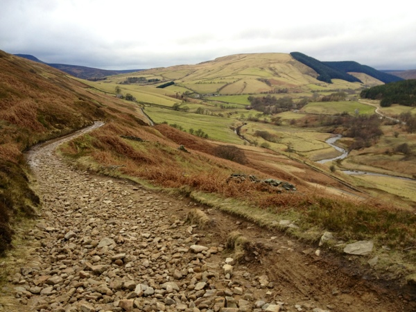
We crossed the road and carried on along the Roman Road. The going was good as we climbed out of the valley away from Hayridge farm that sits at the mouth of Alport Valley. The views were great along this stretch, back across the valley towards Blackden Edge and Blackden Brook. The Old Roman Road is pretty rough from here onwards. Andy and I spoke about how fascinating it would be to be able to turn back the clock and watch the Roman Army march across the valley. The road keeps rising up and up out of the valley until you eventually begin the descent towards Oyster Clough at SK 1195 9050. A quick hope step and jump over the river then you begin the sharp but short climb up towards the Forest. We stopped once again for a quick break and then continued along across the top edge of the Forest. You eventually begin to descend into the pines and there looks to have been some recent logging work here. Large trees have been removed from the clearing and small saplings have begun to grow in their wake. I had never been in this section of the forest before so it was another first for me today. The path rises and falls as you pass above the Snake Inn, it then descends all the way down to the road. We stuck to the path instead of walking along the road and reached the car park at Birchin Clough.
(function() { var po = document.createElement(“script”); po.type = “text/javascript”; po.async = true; po.src = “http://d15mj6e6qmt1na.cloudfront.net/assets/embed.js”; var s = document.getElementsByTagName(“script”)[0]; s.parentNode.insertBefore(po, s); })();
Another fantastic route which we really enjoyed. The northern edge of Kinder Scout never fails to impress no matter what the weather. Today had been a stark contrast to the conditions we had enjoyed the last time we were here. the cold bite of Winter made way for the mild feel of spring today, it really does feel like winter has gone for another year and the days are gradually drawing out again. Thanks for reading and I will have another blog post for you this time next week when I tackle another new route in the Peak District.


